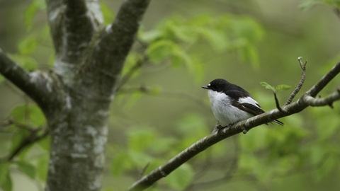
Pied flycatcher (Ficedula hypoleuca) male perched, Wales, UK - Mark Hamblin/2020VISION
Coed y Bedw – Pentyrch
Know before you go
Dogs
When to visit
Amseroedd agor
Open access reserve.Amser gorau i ymweld
May-Aug, Jun-Aug, Oct-FebAm dan y warchodfa
Coed-y-bedw consists of various woodland types. Much of the site occupies a steep north-facing slope following the Garth Hill Coal Measures and the Carboniferous limestone of the Little Garth. Wet Alder woodland in the wetter valley bottom grades through Oak/Birch mixed deciduous woodland to Beech woodland in the northern and western areas. Mixed Ash woodland is locally dominant on the limestone areas to the south.
Two lime-rich springs arise in the southwest of the site and join the acidic stream Nant Cwmllwydrew flowing eastward along the valley floor. This mixture of acidic and calcareous water in the drainage system supports an interesting assemblage of invertebrates, including the uncommon Giant Lacewing, whose larvae develop in the moss clad banks of the streams.


